Satellites can predict floods and provide support by monitoring rainfall, soil moisture levels, land use (identifies areas that are more prone to flooding). In the long-term, it gathers data to predict flood risks and patterns based on current conditions. This information can help in issuing early warnings, planning evacuations, and deploying resources effectively to minimise flood damage.
Disaster Prevention
Floods
Droughts
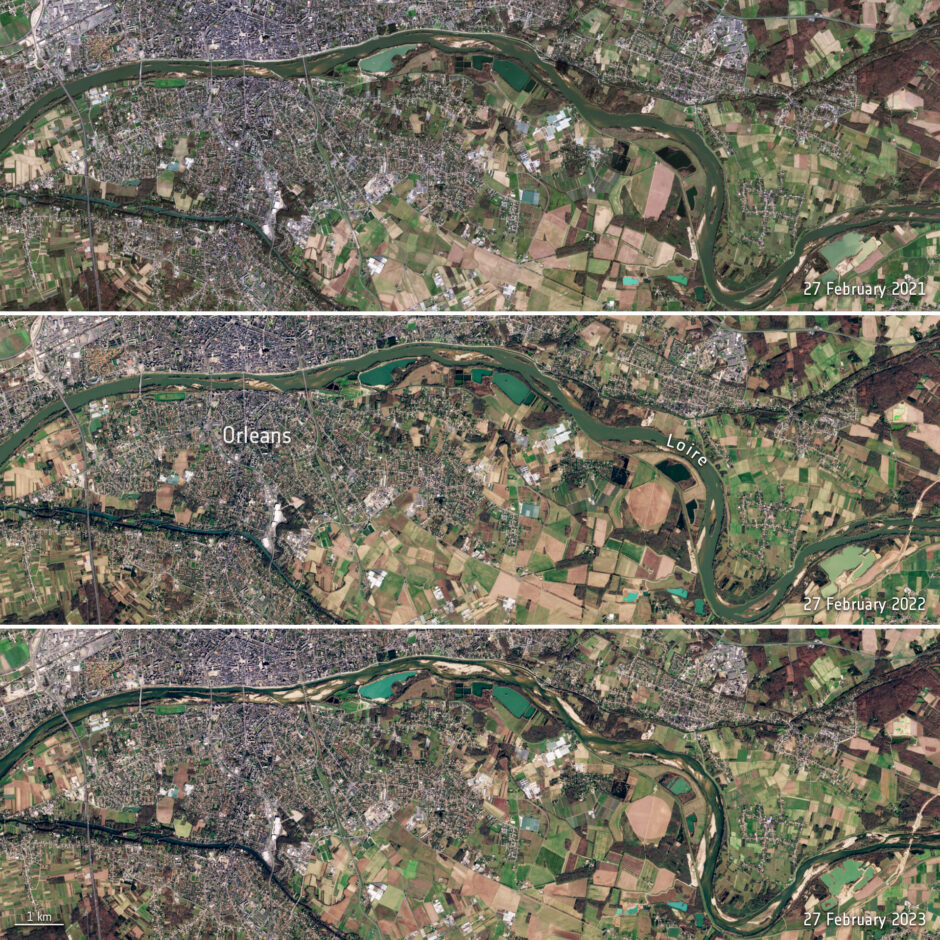
Satellites predict droughts and provide support by monitoring key indicators such as soil moisture, vegetation health, surface temperatures, and water resources. Low soil moisture signals early drought, declining vegetation health indicates water stress, rising temperatures can further deplete soil moisture, and falling water levels point to worsening drought conditions. This data helps governments and organisations implement water conservation measures, manage agricultural practices and prepare communities for drought conditions.
Wildfires
Satellites capture visible and infrared images to detect smoke and flames, enabling rapid wildfire detection. Monitoring vegetation health and dryness helps identify high-risk areas. This data supports decision-making for deploying firefighting resources, planning containment strategies, and assessing burn areas.
Hurricanes
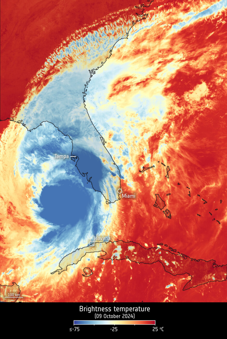
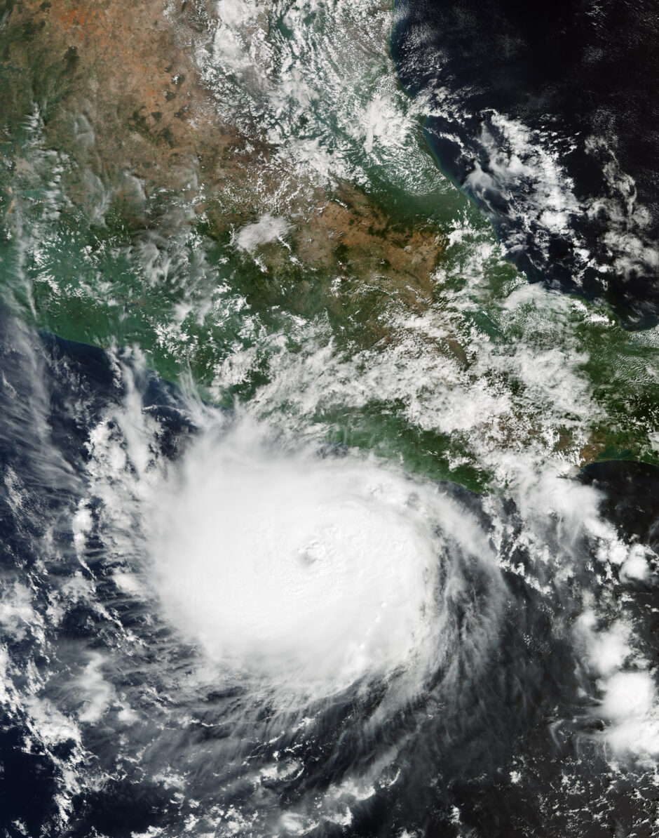
Hurricanes are one of the forces of nature that can be tracked only by satellites, providing up-to-date imagery so that authorities know when to take precautionary measures. Satellites deliver information on a storm’s extent, wind speed and path, and on key features such as cloud thickness, temperature, and water and ice content.
The use of satellites significantly supports disaster prevention efforts for governments and institutions by providing real-time land monitoring. They facilitate early warning systems for natural disasters such as droughts, floods, and wildfires by tracking key environmental factors. This data enables authorities to identify at-risk areas, implement timely evacuations, and allocate resources effectively.
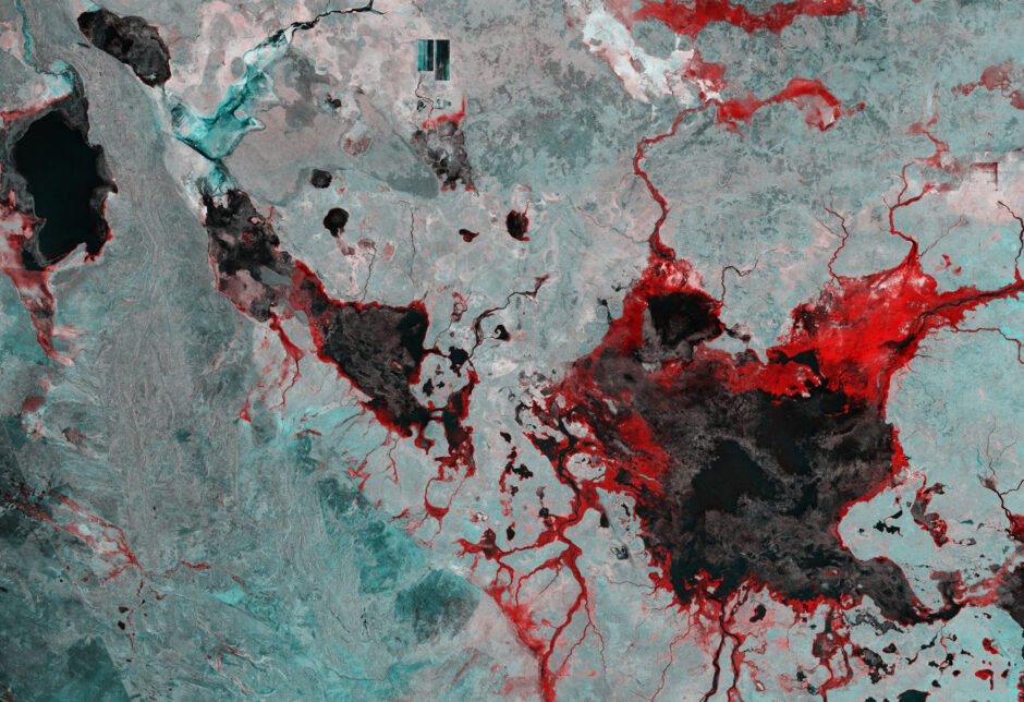
This false-colour radar image combines data from two acquisitions, one from 10 March prior to the rainfall, and one from 22 March after the downpour. Flooded areas are highlighted in red, while dark areas represent permanent water bodies or fields that are frequently submerged.
Tarrabool Lake, the large dark patch in the bottom right, is a seasonal lake whose water level fluctuates. Its swampy wetlands and the nearby tropical forests provide an essential habitat for small mammals, reptiles, and numerous bird species.
Copernicus Sentinel-1’s radar ability to ‘see’ through clouds and rain, and in darkness, makes it particularly useful for monitoring floods. These images can offer immediate information on the extent of inundation, aiding relief efforts. Also, after such events, satellite images are a valuable resource for assessing damage and planning restoration. Credit ESA
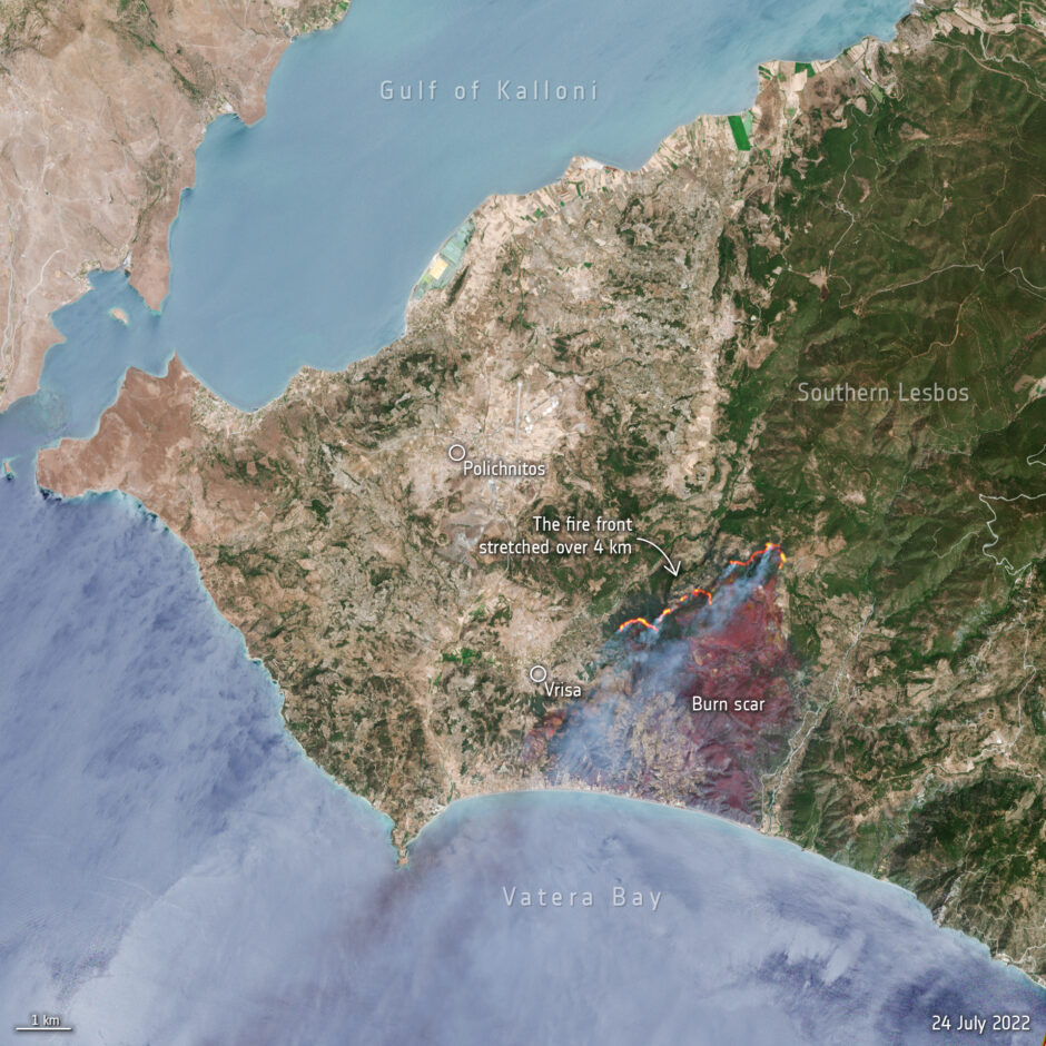
Captured on 24 July 2022, this Copernicus Sentinel-2 image shows a forest fire on the east Aegean island of Lesbos, Greece the active fire front which stretches for more than four km. Thick billowing smoke is visible in the image blowing in a southwest direction. The burn scars left across the land can be identified as a reddish-brown colour and cover an area of around 1700 hectares.
Fifty firefighters along with nine firefighting aircraft worked to extinguish the blaze, along with volunteers and military personnel. In response to the wildfire, the Copernicus Emergency Mapping Service was activated. The service uses satellite observations to help civil protection authorities and, in cases of disaster, the international humanitarian community, respond to emergencies. Credit ESA
